

Like many readers here at MiceChat, we take a lot of park centric vacations. In 2016 that was certainly true, but our objectives weren’t theme parks, but National Parks, specifically, the four park’s of Colorado. Let’s get underway with part three of this adventure.
- Part one can be found here: Colorado Clockwise Part 1
- Part two can be found here: Colorado Clockwise Part 2
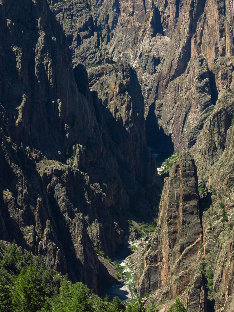
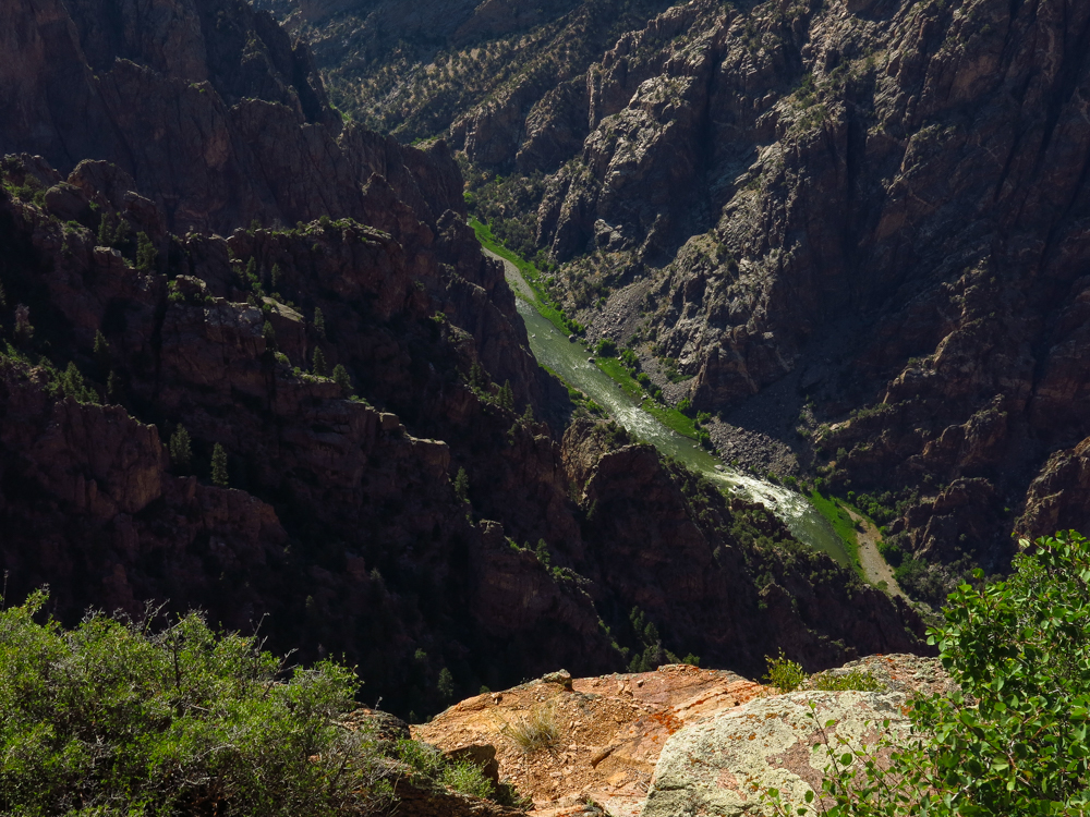
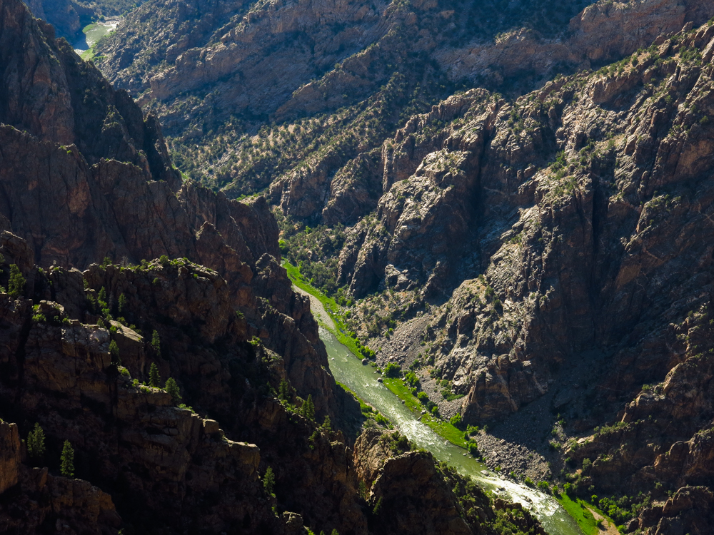
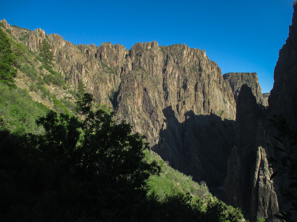
It’s a hard rock story. No, no, there aren’t any electric guitars, fog machines or broken dreams spilling out of broken liquor bottles. This story occurs in the distant mists of time before synergy, tertiary markets or optimizing one’s full potential for maximum fulfillment. This hard rock formed not from record company pressure, but the pressure of the Earth itself, below the surface of Western Colorado, ultimately pushed up by even more pressure. The subterranean pressure continued, eventually leading to a pair of volcanic mountain ranges rising above either side of the hard rock. Pressure then shoved lava and pyroclastic debris into the atmosphere where it then settled over the hard Rock from our tale’s origin. Then, water. Flowing water. Fast flowing water. This water quickly sliced through the volcanic discharge, geologically speaking, and was well into the hard rock below before it realized that it was effectively trapped, destined to form the namesake for Black Canyon of the Gunnison National Park.

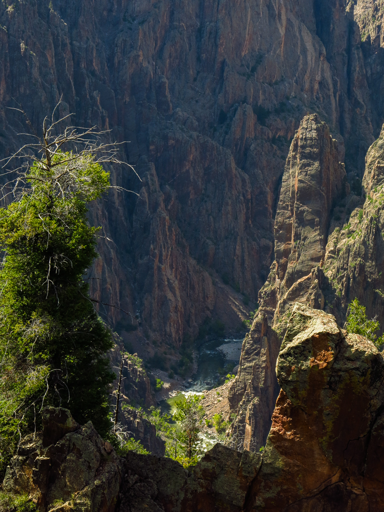
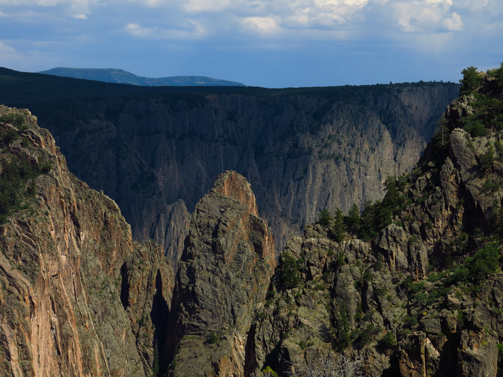
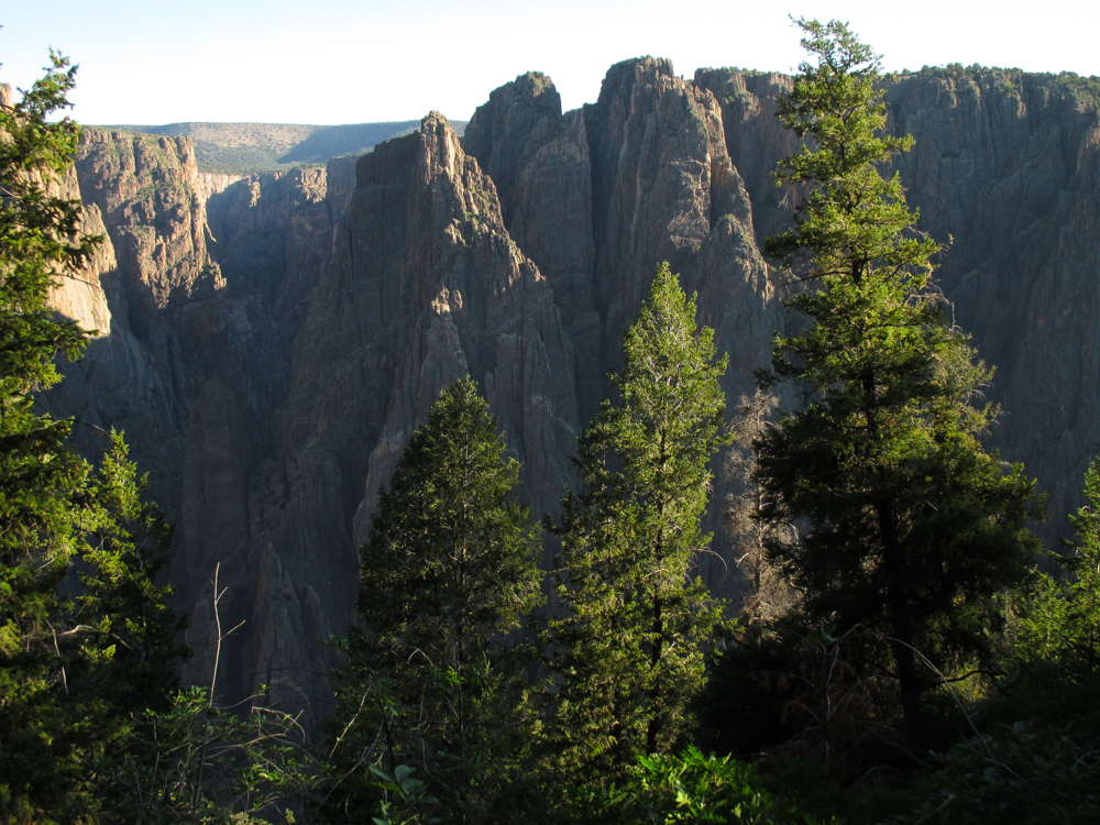
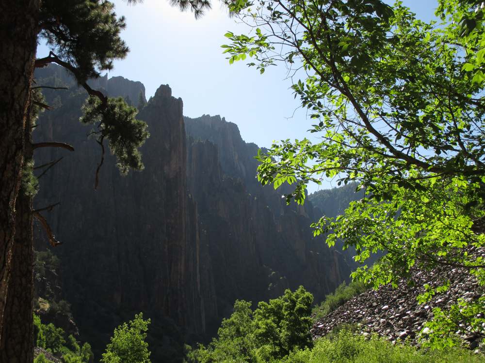
The National Parks System is not lacking for great gorges, Yosemite Valley and the Grand Canyon immediately spring to mind, so obvious that the comparisons are made right there in the glossy fold out map distributed at the entrance kiosk of Black Canyon. The Grand Canyon is both older and deeper, not to mention up to 18 miles wide as the differing properties of the various rock layers allowed a meandering course for the Colorado River. Yosemite was also carved by water, but that included the frozen water of glaciers shearing the walls while widening the floor. Setting the Black Canyon apart is that the swift water had little choice except cutting straight down into the hard rock; taking a meandering route was merely a fantasy for the Gunnison River. It all adds up to a chasm that is never deeper than 2,700 feet, but is so narrow that deep shadows have led to the “Black” designation, and an opposite wall so near it is easily spotted from the window of a passing automobile.

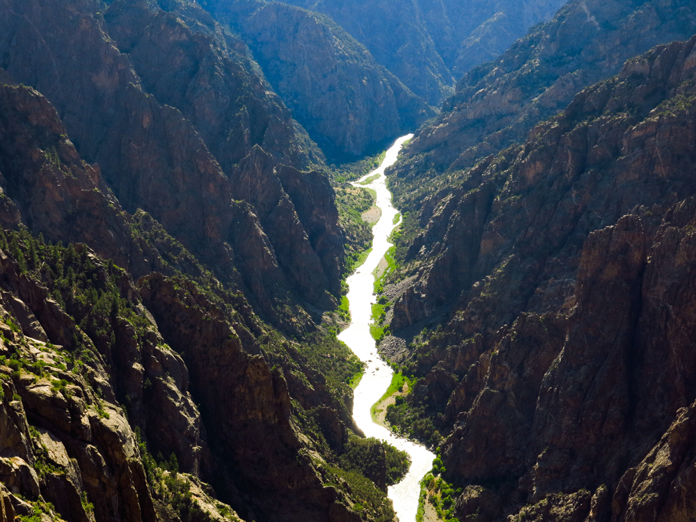
The Gunnison in question is early explorer John Gunnison, whose namesake river drops farther in 48 miles than than the Mighty Mississippi does in 1500, and 14 of those miles are within the park. The North Rim can be explored from the gravel road that follows it, but the majority of visitors stick with the pavement to the south. Numerous pullouts offer easy access to the rim, generally with no exertion beyond a walk of fewer than 5 minutes, and then you’re on the edge, gazing at the river below or the mysterious lines of the Painted Wall, the result of cracks in the original hard rock bring filled with subsequent intrusions of molten earth.


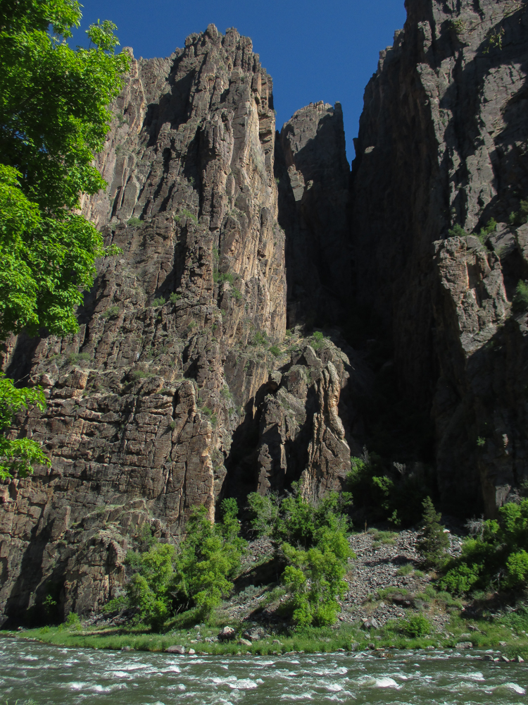
The first to lay eyes on the Black Canyon declared it’s interior to be completely impenetrable, and after taking a peek, I was quite content to accept that declaration without dispute. But it turns out that it is possible to reach the river, and with the promise of a steep, unmaintained trail, unavoidable poison ivy growing over five feet tall, and a river that will kill you with neither malice more remorse, how could we not?
That glossy entrance station map mentioned earlier? It doesn’t show a single trail below the rim
There are a few routes, though. Using any of them requires a free, same day wilderness permit obtained at the Visitor’s Center, and they are available after hours.
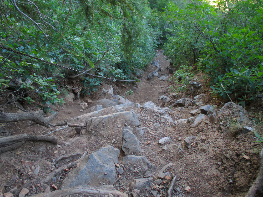
We were at the precipice of the Gunnison Route, the easiest way to reach the river bearing that name. This is a usage of the word “easiest” that was previously unknown to me. For instance, I’ve hiked the Bright Angel Trail into the Grand Canyon with a 5,000 foot elevation change, but it’s making those changes over a 9 mile distance. That averages about 555 feet per mile. The Gunnison Route is a mere mile, but descends 1,800 feet in that distance. I was never a math whiz, but I think that works out to 1,800 feet per mile; so it’s not so much a hike as a controlled fall. It’s pretty obvious to see which way to go, at first. There’s even a length of heavy chain secured to a tree to provide a nontoxic handhold for an all too brief stretch. Reaching the lower depths required regularly triangulating our position with landmarks in anticipation of the inevitable ascent waiting in our futures. There was some sliding and scrambling involved, but our destination was eventually achieved: the beginning of the climb out of that flipping canyon.


No need to rush, right? Got to savor the moment a bit, take it all in. Due to the availability of a couple of decent spots for back-country camping, the Park Service has installed an outhouse; the non-wilderness component being better than camping in what could become a big open sewer. Not a lot of flat ground down there, certainly no beaches, but the shade was welcome, and there was that whole thing about it being visually spectacular in pretty much every direction.


What was lacking in every direction was any sign of a gondola, elevator or incline railway. “The future’s here, we are it, we are on our own”. The climb out is like tackling the stairs of 1 1/2 Empire State Buildings, only with loose rocks and slick dirt instead of stairs. About the time we started wondering aloud if we were drifting off course, we heard the voices of another party about 50 feet to our left. Hitting a dead end and doubling back does not qualify as fun in the dream world that is inhabited by your humble narrator. The rest breaks came more frequently, the breathing more labored, but hope was renewed when the chain was reached. After allowing a descending family to pass, we were pulling ourselves up like Adam West and Burt Ward scaling the Gotham Towers, missing only a cameo appearance by George “Goober” Lindsey to do some shtick. Ultimately the rim was crested, cardiovascular system intact. And that poison ivy? Oh yeah, that’s very real.

When I was a dumb kid, another dumb kid was rolling on a hill that we all knew was covered in poison ivy. Seeing as he didn’t burst into flames or anything, this dumb kid joined him; and paid the price. Thing is, I’ve never been affected again, nor have I ever been affected by poison oak. Now I was not going to push the point, but it did mean Colin got to shower first while I dumped our clothes into the washing machine back at the hotel. By the time heads hit pillows with no intervening itchiness, we knew we were truly out of the Canyon. Good thing, too, because that would have been terribly inconvenient for our next destination in Part 4 of Colorado Clockwise.
You must be logged in to post a comment.