

Alain Littaye goes on a digital flyover of the Disneyland Resort this week as we explore some of the new content that exists in the Apple Maps app. Join us and explore my favorite park in a way you can only do thanks to today’s modern technology. Up, up, and away! ~~Rick
New Apple Maps app update offers 3D Fly Over of Disneyland and Disney California Adventure
by Alain Littaye, Disney and More blog
Two weeks after the “3D Fly Over” feature became available for Disneyland Paris on the Apple Maps App for iPhone/iPad (see my previous articles Disneyland Paris By Air Part One and Disneyland Paris By Air Part Two.) Disneyland and Disney California Adventure have now received the “3D Fly Over” treatment as Apple has updated its app with new Southern California HD satellite pictures!
Disneyland and DCA fans who own an iDevice will be happy to hear this news. The result is the ability to “soar” over the parks in stunning detail that you can observe from any angle. All you have to do is go on “Maps”, enter the keyword “Disneyland”, choose the satellite view, and then the 3D view. This “3D Fly Over” still needs to be improved and likely will be in the future. As long as you don’t zoom too much. the view will be okay and the buildings will not look too distorted.
Let’s start with iPad screen captures of the Disneyland Park. The first aerial view below shows the entrance of both parks.

Here’s an aerial view over Main Street U.S.A and the Jungle Cruise with Tomorrowland on the bottom left.

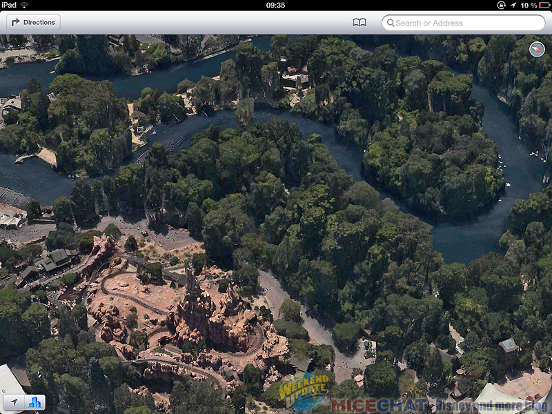
A great bird’s eye view over Frontierland, The Haunted Mansion, Splash Mountain, and Big Thunder Mountain.

A closer look at Big Thunder Mountain and Frontierland river from another angle.
New Orleans Square, Haunted Mansion and Splash Mountain, as well as Tom Sawyer’s Island.

These two views also show Frontierland with Sleeping Beauty Castle and Central Plaza. On the second shot you can see the huge parking lot outside the park on the top left.
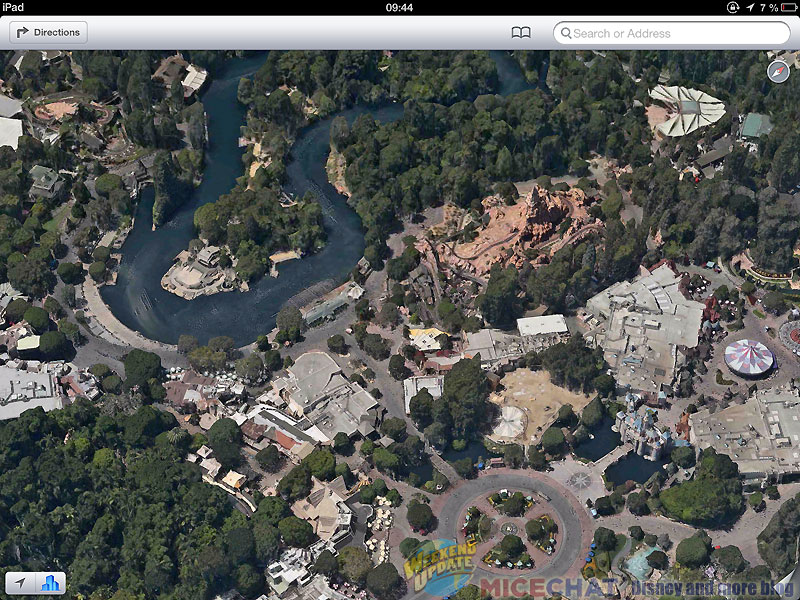
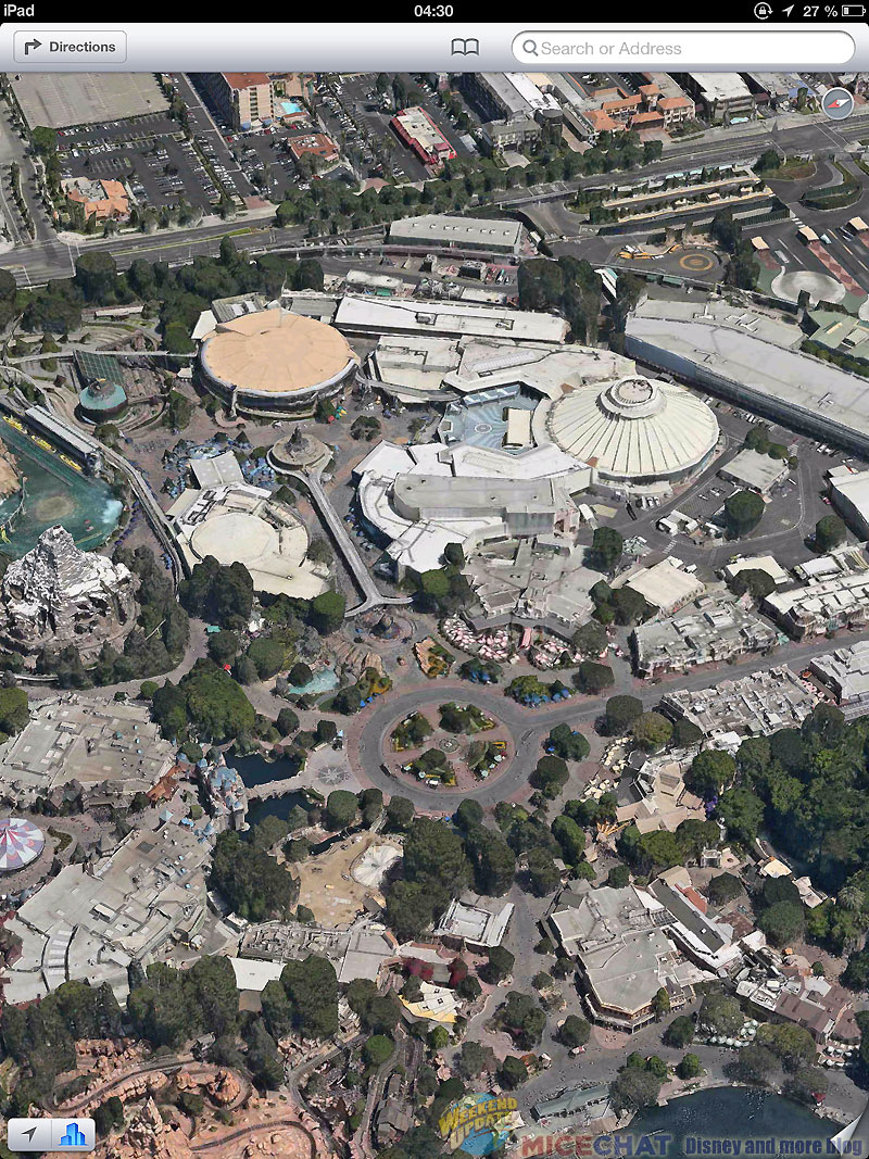
A great view of Fantasyland, including Disneyland’s Matterhorn and even Big Thunder on the top right.
A bird’s eye view of the park as seen from behind New Orleans Square. The building in the bottom right corner is the Indiana Jones Adventure show building.
From over Big Thunder, looking towards Tomorrowland.
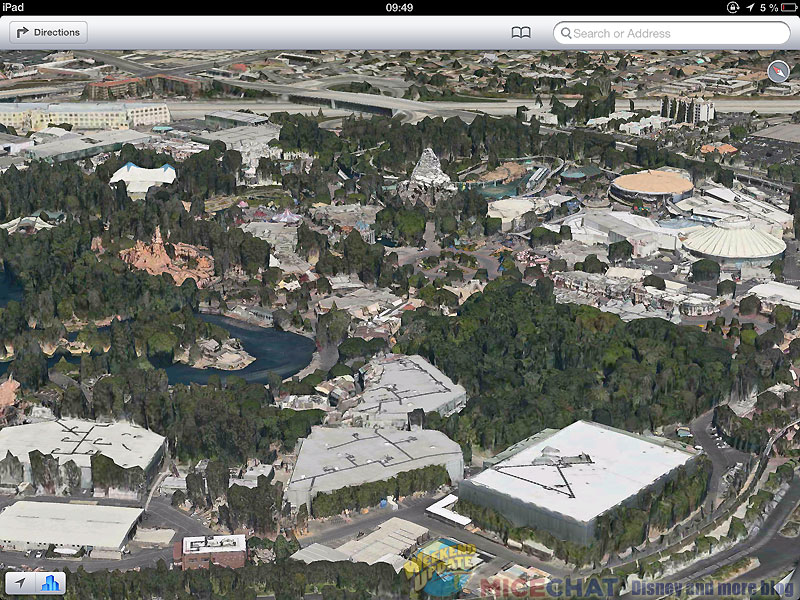
A great view of Autopia, the submarine lagoon, the Matterhorn and on the top left Story Book land, Casey Jr, and It’s a Small World.

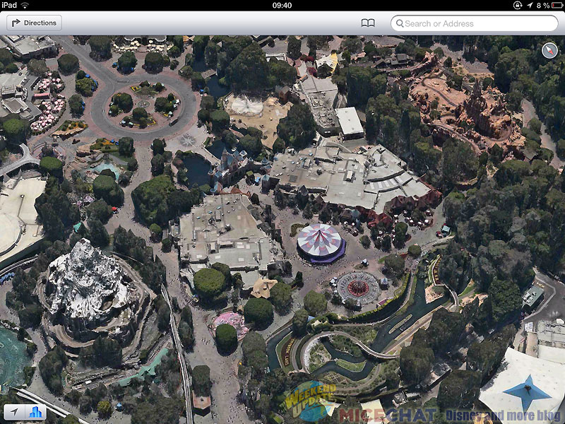
A closer shot of Tomorrowland and the Matterhorn.

Now let’s fly over Disney California Adventure with this great bird’s eye view of the park!
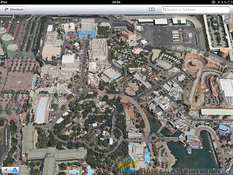
A more vertical view over Grizzly River Run and the park’s entrance.

Two other views of DCA showing Buena Vista Street, Hollywood Land, A Bug’s Land and the Tower of Terror.


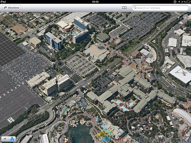
The App is also great to view the Disneyland Resort Hotels. On this next view you have the three of them all together on the same shot!
We will end with a last bird’s eye view of DCA. This one is interesting because the Toy Story and Cast parking lots that you can see at the top may be the location where WDI will end up building the third Anaheim park.

So, if you own an iDevice, go ahead and open the Apple Maps app and have a nice flight over Disneyland and DCA!
Pictures: copyright Apple Maps App
You must be logged in to post a comment.